Eine eigene „MAPS“-Anwendung im Intranet mit Kartendaten, Luftbildern und integrierten fachlichen Informationen?
Kein Problem – auf dieser InGeoForum-Veranstaltung am 14. Mai 2008 erfährt man, wie das geht.
Die Oracle Geodaten-Technologie kommt mehr und mehr bei Kunden und Partnern an. Als nächstes werden wir (Carsten Czarski) sie beim InGeoForum vorstellen - das InGeoForum dient der Information und Kooperation zwischen Anbietern und Nutzern von Geodaten, -Informationssystemen und -Dienstleistungen.
In der eintägigen Veranstaltung wird unter anderem vorgestellt, wie man eine Karte mit Oracle MAPS in 15 Minuten ins Internet oder Intranet bringen kann. Neben Oracle werden auch die Oracle Partner Mettenmeier und GDV den Einsatz unserer Technologie vorstellen.
Ein MUSS für jeden Kunden, der an Geodaten interessiert ist (und wer hat noch nie Google Maps genutzt?)
Weitere Informationen zum Thema und Anmeldemöglichkeit: www.ingeoforum.de
29 April 2008

12 March 2008
Oracle Maps und der JDeveloper 11g
Auch wenn ich nicht gerne Content produziere durch einfaches Verlinken, möchte ich meine Besucher und speziell JAVA Entwickler hier auf diese 2 neuen (Februar und März 2008) BLOG Beiträge von Andrejus Baranovski hinweisen:
1. Oracle Maps in JDeveloper 11g - Even More Simple (Febr. 2008)

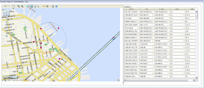
Mit Suchergebnis neben der Karte.
Beides beruht auf den neuen Visualisierungs-Komponenten des Oracle JDeveloper 11g - Technical Preview 3"out-of-the-Box".
17 February 2008
Geodaten Live Erleben ! Hands-On Workshop in Hamburg 4.3.08
Update 11.03.08: der Workshop war mit 22 Teilnehmern ein voller Erfolg ! Es hat alles gut geklappt und die meisten sind mit Oracle Spatial Projekt Ideen wieder nachhause gefahren.
In Düsseldorf (12 Teilnehmer) und Stuttgart (25 TN) war die Resonanz ebenso groß und positiv.
Update 29.2.08: der Workshop ist mittlerweile ausgebucht !
Am 4.3. biete ich mit meinem Kollegen Carsten Czarski einen ersten "Hands-On-Workshop" zum Thema Oracle Maps und Oracle Spatial in der Oracle Ndl. in Hamburg (Kühnehöfe 5) an; es sind noch ein paar Restplätze frei !
Beginn 10:00h - Ende ca. 17:30h
Vormittags: Oracle Spatial Überblick, Basics und ein paar Übungen
Nachmittags: Karte erstellen u. erweitern basierend auf Oracle Maps innerhalb APEX 3.0
Mitzubringen: Laptop mit WLAN Karte und Browser - wir nutzen eine Infrastruktur im Internet (APEX Workspace, Datenbank, AS Mapviewer/Oracle Maps).
Bei Interesse bitte an mich mailen: Bernhard.Fischer-Wasels (at) oracle.com und formlos anmelden (und auf Bestätigung warten)
In Düsseldorf (12 Teilnehmer) und Stuttgart (25 TN) war die Resonanz ebenso groß und positiv.
Update 29.2.08: der Workshop ist mittlerweile ausgebucht !
Am 4.3. biete ich mit meinem Kollegen Carsten Czarski einen ersten "Hands-On-Workshop" zum Thema Oracle Maps und Oracle Spatial in der Oracle Ndl. in Hamburg (Kühnehöfe 5) an; es sind noch ein paar Restplätze frei !
Beginn 10:00h - Ende ca. 17:30h
Vormittags: Oracle Spatial Überblick, Basics und ein paar Übungen
Nachmittags: Karte erstellen u. erweitern basierend auf Oracle Maps innerhalb APEX 3.0
Mitzubringen: Laptop mit WLAN Karte und Browser - wir nutzen eine Infrastruktur im Internet (APEX Workspace, Datenbank, AS Mapviewer/Oracle Maps).
Bei Interesse bitte an mich mailen: Bernhard.Fischer-Wasels (at) oracle.com und formlos anmelden (und auf Bestätigung warten)
12 February 2008
Marquee Zoom Funktion in der Karte

eine coole Funktion habe ich eben ausprobiert und eingebaut: MARQUEE ZOOM
Cool deswegen, weil die Funktionalität auch innerhalb der Karte einzubauen ist.
(übrigens LIVE zu sehen hier: http://elocation.oracle.com/elocation/ajax/ - und im Buch Pro Oracle Spatial für Oracle Database 11g auf Seite 517 beschrieben)
Man kann in der neuen Version (preview 11g - seit 12.12.07 downloadbar) unterscheiden zwischen 3 Modes:
- Prompt:
Man zeichnet das Rechteck auf der Karte und klickt danach in das Rechteck hinein - und die Karte zoomed hinein. Klickt man ausserhalb des Rechtecks, passiert nichts.
- Continuous:
Man zeichnet das Rechteck und läßt die Maustaste los - und sofort wird gezoomt. Der Marquee Zoom bleibt solange aktiv, bis man die Checkbox wieder ausklickt.
- One time (one_time):
Man zeichnet das Rechteck und läßt die Maustaste los - es wird gezoomt und anschliessend ist das Werkzeug inaktiv.
Zum Einbau in der Karte kombiniere ich zwei (drei) Oracle Maps Funktionen:
"startMarqueeZoom" (Instance method in class MVMapView)
"stopMarqueeZoom()" (Instance method in class MVMapView)
und
"MVMapDecoration"
"MVMapDecoration" ermöglicht dem Entwickler irgendetwas (HTML/Javascript) auf der Karte zu platzieren.
Weitere Erläuterungen im Oracle Maps Tutorial # 19 Map Decoration.
"startMarqueeZoom" und "stopMarqueeZoom()" liefert die Rechteckauswahl mit obigen Funktionalitäten.
Weitere Erläuterungen im Oracle Maps Tutorial # 33 Marquee Zoom.
In den Oracle Maps Tutorials ist halt nur nicht so smart die Funktion in die Karte eingebaut, sondern neben der Karte angeordnet.
Codesnippet:
// Marquee Zoom control/HTML auf der Seite einbauen:
var toolBar =
'<div style="background-color:white; border:2px solid black;">'+
' Rechteck Zoom: '+
'<input id="marqueezoom" type="checkbox" value="marqueezoom" onclick="toggleMarqueeZoom(this)" unchecked/>'+
' Entfernung: '+
"<INPUT id='distarea' title='Measure distance/area' TYPE='checkbox' value='distarea' onclick='measureDistanceArea(true)' unchecked/>"
'</div>'
// Funktion MVMapDecoration zum Platzieren in der Karte hinzufügen:
md = new MVMapDecoration(toolBar, 0, 0) ;
mapview.addMapDecoration(md);
md.setOffset(5, 5) ;
// die Marquee Zoom Control Funtion einbauen:
function toggleMarqueeZoom(checkBox)
{
if(checkBox.checked)
mapview.startMarqueeZoom("prompt");
else
mapview.stopMarqueeZoom() ;
}
Zur Erläuterung der Entfernungs Messungs Funktion komme ich später... (;-)
09 January 2008
JDeveloper: Geographic Map data visualization component als OBE
Das JDeveloper Team stellte am 22.12.07 ein Preview 3 auf OTN:
http://www.oracle.com/technology/software/products/jdev/index.html
mit einer/m: "Geographic Map data visualization component":

Ein Tutorial in der Serie Oracle By Example (OBE)ist auch verfügbar. Alle OBE - überall alle Technologien übrigens hier.
Ich hatte die Vorversion im Dezember 07 auch schon mal hier im BLOG erwähnt.
Ich habe es noch nicht alles getestet.
HINWEIS: Zum Thema ADF gibt es einen sehr attraktiven Hands-On-Workshop am 7.2.08 (Do. 16-20h)in Bremen organisiert von der DOAG Regio Gruppe in Bremen (begrenzte Plätze !)
http://www.oracle.com/technology/software/products/jdev/index.html
mit einer/m: "Geographic Map data visualization component":

Ein Tutorial in der Serie Oracle By Example (OBE)ist auch verfügbar. Alle OBE - überall alle Technologien übrigens hier.
Ich hatte die Vorversion im Dezember 07 auch schon mal hier im BLOG erwähnt.
Ich habe es noch nicht alles getestet.
HINWEIS: Zum Thema ADF gibt es einen sehr attraktiven Hands-On-Workshop am 7.2.08 (Do. 16-20h)in Bremen organisiert von der DOAG Regio Gruppe in Bremen (begrenzte Plätze !)
07 January 2008
Master/Detail Window - "Nested Maps"
Danke an Friedhold Matz für seine sehr detaillierte Beschreibung einer "Master/Detail Window" Funktion in seinem BLOG!
Hier nur der Querverweis zu Part 1 und Part 2 :

mit Demo Video ! Super ! Muchas Gracias !
Hier nur der Querverweis zu Part 1 und Part 2 :

mit Demo Video ! Super ! Muchas Gracias !
04 January 2008
Datasource persistent machen - Map-Tile-Layer (Basemap) als Cache anlegen
Es tauchte die Frage auf:
Wie mache ich die "Datasource" im Mapviewer persistent ?
Mapviewer (oben rechts ADMIN) aufrufen:
http://localhost:8888/mapviewer/faces/admin/admin.jspx
user/pwd: oc4jadmin/oc4jadmin
dann Link: "Configuration" und die "permanente" Datasource editieren, sodass es z.B. so aussieht:

Tipp: das Passwort mit einem ! beginnen lassen, z.B. so: !mvdemo
nur dann wird es beim Save und Restart verschlüsselt.
Man kann auch die dort vorhandene Beispiel- Datasource editieren und "auskommentieren".
Bitte aufpassen, dass der Abschnitt nicht evtl durch '<'!-- ********** --'>'
Ob das Speichern geklappt hat, sieht man daran, dass das Passwort verschlüsselt wurde (wie oben).
--> "allow_jdbc_theme_based_foi="true" <-- unbedingt auf true setzen, sonst funktioniert das mit dem jdbc_theme nicht !!
und dann gaaaannnnz unten '<'save and restart '>'drücken
Von diesen Datasources kann man selbstverständliche mehrere machen (untereinander für jeweils verschiedene Schemata/User).
Danach erscheint die Datasource auch unter "DATASOURCES" im Mapviewer Admin:

Um jetzt für Oracle Maps, etwas zu sehen, muß man für die "Basemaps" - heisst jetzt: "Map Tile Layers" noch den Cache anlegen bzw. die "Map Tile Layers" (pro Basemap) -
bei 10.1.3.1: Manage Map Caches - ab 10.1.3.2 (=11g): Manager Map Tile Layers

Auf "Create" klicken und "INTERNAL" auswählen - dann ausfüllen wie folgt:

Hinweis: Bitte unten "SUBMIT" (=speichern) klicken und nicht oben "Return" (=zurück/abbrechen)
Nun sollte die Oracle Maps Demo laufen und Karten sind zu sehen...
Neu im Mapviewer 11g (10.1.3.1) ist übrigens die Möglichkeit, die Karten des "Map-Tile-Layers" (früher BASEMAP) direkt anzuschauen:
Dazu in der Übersichtsliste den "Map-Tile_Layer" auswählen und "view" anklicken.
Zunächst ist die Karte leer.
Nun die Center X (geograf.Länge und Center Y (geograf.Breite) für die Karte eingeben - dann erscheint:

Viel Erfolg damit !
Wie mache ich die "Datasource" im Mapviewer persistent ?
Mapviewer (oben rechts ADMIN) aufrufen:
http://localhost:8888/mapviewer/faces/admin/admin.jspx
user/pwd: oc4jadmin/oc4jadmin
dann Link: "Configuration" und die "permanente" Datasource editieren, sodass es z.B. so aussieht:

Tipp: das Passwort mit einem ! beginnen lassen, z.B. so: !mvdemo
nur dann wird es beim Save und Restart verschlüsselt.
Man kann auch die dort vorhandene Beispiel- Datasource editieren und "auskommentieren".
Bitte aufpassen, dass der Abschnitt nicht evtl durch '<'!-- ********** --'>'
Ob das Speichern geklappt hat, sieht man daran, dass das Passwort verschlüsselt wurde (wie oben).
--> "allow_jdbc_theme_based_foi="true" <-- unbedingt auf true setzen, sonst funktioniert das mit dem jdbc_theme nicht !!
und dann gaaaannnnz unten '<'save and restart '>'drücken
Von diesen Datasources kann man selbstverständliche mehrere machen (untereinander für jeweils verschiedene Schemata/User).
Danach erscheint die Datasource auch unter "DATASOURCES" im Mapviewer Admin:

Um jetzt für Oracle Maps, etwas zu sehen, muß man für die "Basemaps" - heisst jetzt: "Map Tile Layers" noch den Cache anlegen bzw. die "Map Tile Layers" (pro Basemap) -
bei 10.1.3.1: Manage Map Caches - ab 10.1.3.2 (=11g): Manager Map Tile Layers

Auf "Create" klicken und "INTERNAL" auswählen - dann ausfüllen wie folgt:

Hinweis: Bitte unten "SUBMIT" (=speichern) klicken und nicht oben "Return" (=zurück/abbrechen)
Nun sollte die Oracle Maps Demo laufen und Karten sind zu sehen...
Neu im Mapviewer 11g (10.1.3.1) ist übrigens die Möglichkeit, die Karten des "Map-Tile-Layers" (früher BASEMAP) direkt anzuschauen:
Dazu in der Übersichtsliste den "Map-Tile_Layer" auswählen und "view" anklicken.
Zunächst ist die Karte leer.
Nun die Center X (geograf.Länge und Center Y (geograf.Breite) für die Karte eingeben - dann erscheint:

Viel Erfolg damit !
13 December 2007
Projekte mit Mapviewer und/oder Oracle Maps
In diesem Beitrag werde ich so nach und nach Projekte und Lösungen sammeln, wo Mapviewer oder Oracle Maps zum Einsatz gekommen sind:
Entschädigungs Management am Flughafen Düsseldorf - realisert von Geomapping, Hildesheim -
(Oracle Referenzstory)
Entschädigungs Management am Flughafen Düsseldorf - realisert von Geomapping, Hildesheim -
(Oracle Referenzstory)
11 December 2007
Oracle Fusion Middleware MapViewer 11g R1 Preview 1 - als DOWNLOAD
Frohe Botschaft vor dem Fest: Seit gestern gibt es eine neue MAPVIEWER Version und insbesondere ORACLE MAPS mit den schon erwähnten erweiterten Tutorials und js-Funktionalitäten als "Preview" (der Oracle Application Server bzw. die Oracle Fusion Middleware 11g kommt ja erst nächstes Jahr...) hier zum DOWNLOAD (41 MB).
In dem zip File (41MB) sind auch ein neuer "MAPBUILDER" (mapbuilder.jar) und die MVDEMO-Daten enthalten.
Es wird nochmal daruaf hingewiesen, dass es sich um ein PREVIEW handelt, der nicht supported ist (wie bisher immer schon).
Viel Spaß und Erfolg damit !
Ich habe zum schnellen Durchlesen hier mal mit aufgenommen, was alles neu ist bzw. was der Mapviewer (core) für Funktionalitäten mitbringt (aus dem "What's New"):
OracleFMW MapViewer 11g R1 (preview 1) - New and changed features since 10.1.3
MapViewer Core
In dem zip File (41MB) sind auch ein neuer "MAPBUILDER" (mapbuilder.jar) und die MVDEMO-Daten enthalten.
Es wird nochmal daruaf hingewiesen, dass es sich um ein PREVIEW handelt, der nicht supported ist (wie bisher immer schon).
Viel Spaß und Erfolg damit !
Ich habe zum schnellen Durchlesen hier mal mit aufgenommen, was alles neu ist bzw. was der Mapviewer (core) für Funktionalitäten mitbringt (aus dem "What's New"):
OracleFMW MapViewer 11g R1 (preview 1) - New and changed features since 10.1.3
MapViewer Core
- Secure Map rendering
MapViewer now supports secure map rendering based on a Web user's identity. Users with different roles or permissions will see different feature sets when viewing the same theme. - WFS Themes
Web Feature Service (WFS) features can now be viewed through MapViewer's WFS themes. These themes support the parsing and caching of WFS capabilities, and the use of feature conditions and queries. WFS theme support also works with Oracle Maps; for example, you can display a WFS theme as an interactive feature of interest (FOI) layer. - Map Builder Enhancements
The Map Builder tool now supports the creation of WFS themes and Annotation Text-based themes. The base map panel also supports identifying features (and a list of rendered themes) on mouse clicks. - Improved Non-spatial Data Provider Support
MapViewer now supports a default provider and format for applications to supply XML-based non-spatial data for thematic mapping. You can also specify columns from the non-spatial data set to be used in conjunction with an advanced style. - Multiple Rendering Styles for a Single Feature
Previously, a feature could be rendered by only one rendering style. You can now use multiple rendering styles when rendering a theme's features. For example, you can shade a polygon with a color style while also plotting a pie chart on top of it, without defining two themes. This is done using stacked styles in a theme's definition. - Automatic Reduction of Repetitive Labels
Previously, repetitive street labels or highway shields on linear features were displayed when such features consisted of many small segments. You can now use the Map Builder tool to specify the No Repetitive Labels option in the base map properties, to cause features (such as road segments) with same name to be labeled only once. For information about specific options in Map Builder, see the online help for that tool. - MapViewer Java Portlet Specification (JPS) Portlet
MapViewer now comes with a simple JSR 168-compliant Portlet that enables easy inclusion within an enterprise portal based on the Oracle Web Center technology (not available in this preview). - Scale Ranges for Theme Labeling
In the context of a base map, you can now assign scale limits to its themes' labels. These scale limits control when a theme's features will display their label texts. - PDF Output
Full PDF map output support is provided. If you use PDF_URL or PDF_STREAM as the map format in your XML map request, MapViewer will generate vector PDF maps. - Text Style Enhancements
The TEXT style has been improved to support customizable spacing between letters. It also supports additional (vertical) alignment options when labeling linear features. Text decorations such as underline, linethrough, overline have been added as well as line spacing. - LINE Style Enhancement
LINE styles can now have repetitive markers/patterns decorated along the path. - Custom Tags for Theme and Base Map Definitions
The XML definition of a theme or base map now supports application-specific attribute tags. You can use the Custom Tags option in the theme definition in Map Builder to specify tags and their values, which can be interpreted by your application but are ignored by MapViewer itself. - Getting Style Names Referred to in a Predefined Theme
The newelement enables you to get the names of styles referred to in a predefined theme. - Annotation Text
Support is provided for OpenGIS Consortium standard annotation text. Oracle Spatial in Oracle Database Release 11g supports storage of annotation text objects in the database, and MapViewer now supports displaying such annotation texts on a map. - Logging Mechanism Changes
A new logging mechanism based on Java logging is provided. You can also use the Oracle Application Server management console to customize how MapViewer logs things at run time. - Custom (External) Spatial Data Providers
MapViewer now supports rendering of geospatial data stored in non-Oracle Spatial repositories. This is achieved through a Custom Spatial Data Provider API, where you can implement an Interface that feeds your own (proprietary) spatial data to MapViewer for rendering. Note that you will still need an Oracle Database to manage the mapping metadata, such as styles and themes definitions. - User-Specified JDBC Fetch Size for Predefined Themes
You can now specify a non-default row fetch size on a theme, by setting the Fetch Size base map property with the Map Builder tool. MapViewer can use this value when fetching theme features from the database. Specifying an appropriate value can make performance tuning easier in certain situations. - SQL/MM standard ST_XXX type support
MapViewer now supports rendering data stored in the SQL/MM ST_XXX geometry types, in an Oracle database.
North arrow element can be added to a map request - Map rotation support
You can now request a map that is rendered in a specified orientation or angle.
Oracle Maps :
- MVBaseMap Renamed to MVMapTileLayer
The class MVBaseMap in the Oracle Maps Javascript API is renamed to MVMapTileLayer to prevent possible confusion with the concept of MapViewer base map. For more information, see the JavaScript API documentation for MVMapTileLayer on your MapViewer home page. - Web-Based User Interface for Map Tile Layer Management
A new Web-based user interfaced has been added to the MapViewer Web admin console for editing map tile layer definitions, as well as previewing and managing map tiles. - External Map Tile Support
The Oracle Maps JavaScript client can now display map tiles rendered directly by an external map tile server without caching the tiles with the MapViewer map tile server. For more information, see the JavaScript API documentation for MVCustomMapTileLayer. - Improved Client-Side Support for Accessing Cross-Domain Map Tile Server and FOI Server
The Oracle Maps client can now communicate with cross-domain map cache tile and FOI servers without relying on a proxy server, which was previously
required. For more information, see the JavaScript API documentation for MVMapView.enableXMLHTTP. - Dynamic Client Side Styles
More support is provided for rendering FOI data using dynamic client side styles for business intelligence (BI) applications. New classes are added to the Javascript API to support client side defined styles such as color style (MVStyleColor), marker style (MVStyleMarker), bar chart style (MVBarChartStyle), pie chart style (MVPieChartStyle), bucket style (MVBucketStyle), as well as any MapViewer supported style defined in XML (MVXMLStyle). - JDBC Theme-Based FOI
Oracle Maps now supports client side dynamically constructed JDBC theme-based FOI layers. For more information, see the JavaScript API documentation for MVThemeBasedFOI. - Simplified Dynamic BI Data Injection and Visualization
Business Intelligence applications can now visualize application generated nonspatial attribute data on the map through the combined use of a nonspatial data provider and theme-based FOIs. For more information, see the JavaScript API documentation for MVNSDP. - Improved Information (tool-tip) Window
The positioning, styling, and sizing of the information window have been improved. Previously, the Oracle Maps client always displays the information window at a fixed position relative to the specified map location. The Oracle Maps client now can place the information window at the optimal variable position relative to the specified map location. As the result, the map does not to be panned in order to make the information window visible inside the map. - Enhanced Map Decoration
The client now supports multiple collapsible map decoration components that can be positioned at arbitrary positions inside the map container. Map decoration can now be dragged inside the map container. For more information, see the JavaScript API documentation for MVMapDecoration. - Flexible Placement and Visibility control for Navigation Panel and Scale Bar
The navigation panel and the scale bar can now be placed inside a map decoration component, which can be displayed or hidden and can be placed at a position of your choice inside the map container. - Polygon Theme-Based FOI Layer Labeling
Applications can now choose whether to label the polygon features of a polygon theme-based FOI layer. For more information, see the JavaScript API documentation for MVThemeBasedFOI. - Image-Less Polygon Themes with FOI Layers
You can now base a feature of interest (FOI) layer on an image-less polygon theme, causing FOI images not to be rendered if the theme is already rendered as part of the base map. This feature can result in much faster performance with polygon layers. For more information, see the JavaScript API documentation for MVThemeBasedFOI. - FOI Layer Automatic Selection and Highlighting
You can now associate a filtering geometry with any predefined theme-based FOI layer so that only the features that fall inside the filtering geometry are rendered on the map. This feature is part of the new support for proximity and within-distance mapping. It can be used with the selection tools (circle, rectangle, or polygon) to implement theme feature highlighting. For more information, see the JavaScript API documentation for MVThemeBasedFOI. - Client-Side Construction of Geodetic Geometries Based on Earth Distance Parameters
You can now construct the following type of geometries in geodetic coordinate systems with parameters based on Earth distance: a circle polygon geometry specified by its center and radius, a rectangle with its height and width specified, and a point geometry at the specified distance and bearing from the start point. These geometries, especially the first two, can be used for implementing proximity and within-distance type mapping. For more information, see the JavaScript API documentation for MVSdoGeometry. - Animated Loading Icon for Maps and Themes
The Oracle Maps client now displays an animated icon during the loading of a base map or a theme. This is especially useful for providing visual reassurance to users with maps and themes that take a long time to load. - User-Defined FOI Customizations
The JavaScript API now provides methods for applications to modify the geometry representation and rendering style of an already rendered user-defined FOI, as well as the custom marker image for a user-defined point FOI. For more information, see the JavaScript API documentation for MVFOI. - Prompt Mode for Marquee Zoom Tool
The new prompt mode provides enhanced user control over marquee zoom operations. Prompt mode zooms the map when the use clicks on the marquee zoom rectangle, which eliminates the possible problem of accidental zooming associated with "continuous" mode. For more information, see the JavaScript API documentation for MVMapView.startMarqueeZoom. - Mouse Cursor Customization
Applications can now customize the appearance of the mouse cursor when the cursor is over different map components, such as map tiles, FOIs, and map decorations. - Error Reporting
Previously, all error messages thrown by the Oracle Maps client were displayed as browser alerts. Now applications can customize how the error messages are handled by using a custom error handler. For more information, see the JavaScript API documentation for MVMapView.setErrorHandler. - New Tutorials
Many new Oracle Maps tutorials illustrate the new features. To access the MapViewer demos and tutorials, go to:
http://host:port/mapviewer/fsmc/tutorial/demos.html
05 December 2007
Oracle Maps mit JDeveloper R.11 und ADF R.11

Oracle Consulting (Teresa Korzec) realisierte kürzlich eine Integration von Oracle Maps mit JDeveloper 11g / ADF R.11.
Diese "Map"-Komponente ist zwar noch in BETA, aber illustriert schon einmal mehr den "Services" - oder "Komponenten"-Ansatz, den Oracle bei der Webanwendungsentwicklung immer stärker verfolgt.
Auf dem wiki.oracle.com habe ich mal eine Seite eingerichtet, wo gesammelt wird, mit welchen Technologien Oracle Maps mittlerweile (dokumentiert) integrierbar ist.
Dies Beispiel wurde auch auf der diesjähreigen Oracle Open World in San Francisco von Oracle Spatial Product Manager Jayant Sharma präsentiert.
Die Story behind it:
Ein großer Kunde wollte gerne "seine" Daten inkl. räumlicher Bezüge (Geodaten) attraktiv in einer Anwendung präsentiert bekommen.
So ließen sie sich eine Flash-Animation von einer "Media-Agentur" entwickeln, um zu sehen, wie soetwas aussehen könnte.
DIESE Flash-Annwendung macht sich Oracle dann zur Aufgabe als "richtige" Webanwendung umzusetzen. Das Ergebnis sieht man oben.
Hier ist ein vertontes Viewlet über die Integration von JDeveloper & ADF und Oracle Maps auf der Oracle JDeveloper Online Demos Seite unter dem Namen: "Geographical Maps and Pivot Table JSF Components (New)" zu finden.
Subscribe to:
Posts (Atom)